

Lunch Rock provides nice views down Wolf Creek to the Flathead Valley! (Keith Hammer photos)
Eleven Swan Rangers hiked from Bear Creek to Wolf Creek on a hot Saturday, August 1, 2015!
They used the early morning shade of Broken Leg Mountain and an early return to make a very hot day an enjoyable hike!
Sorry, there is no map that shows this secret route from Bear Creek to Wolf Creek!
(Read Full Article)
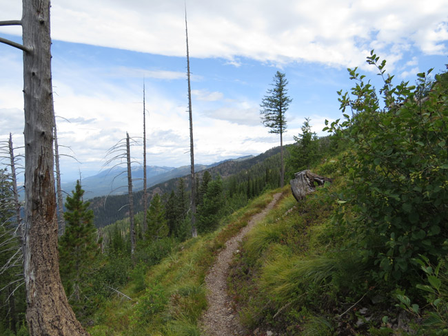
Peterson Creek Trail crossing the Red Owl burn! (Keith Hammer photos)
Fourteen Swan Rangers hiked the Peterson Creek Trail on Saturday, July 25, with most turning around after lunch in the Red Owl burn and a few continuing on to the Quintonkon divide!
There were great views, laughs and ripe huckleberries to be had along the way!
Click here for a map of the Peterson Creek Trail!
(Read Full Article)
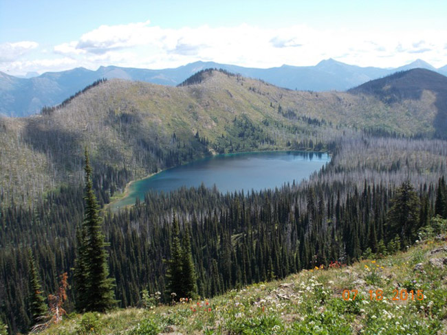
Clayton Lake viewed from Tongue Mountain, with Pioneer Ridge beyond. (Roger Benson photo)
Eighteen Swan Rangers broke into smaller groups and hiked Jewel Basin on Saturday, July 18, with most hiking out Tongue Mountain to overlook Clayton Lake!
The groups found wildflowers and wild bees galore at higher elevations, whether on Tongue Mountain or along Alpine 7 above Jewel Lakes!
Click here for a map of the Jewel Basin Hiking Area.
(Read Full Article)

Swan Rangers at the Swan River Oxbow Preserve kiosk. (Keith Hammer photos unless otherwise noted)
Thirteen Swan Rangers hiked The Nature Conservancy's Swan River Oxbow Reserve on Saturday, July 11, while one lone Ranger hiked to Sixmile Peak for a little more elevation and lung exercise!
While the wetlands trails didn't readily offer up any of the rare and threatened water howellia, they did offer up a variety of wonderful plant and tree species, seasoned with a healthy dose of mosquitos!
The Rangers first visited this pair of nature trails on February 28, vowing to return sans snow and high water!
(Read Full Article)

View of Peters Ridge, Echo Lake and Flathead Lake from the Swan Crest! (Keith Hammer photos unless otherwise noted).
Thirteen Swan Rangers hiked the Peters Ridge Trail and cleared it of deadfall on Saturday, July 4, and five continued on to Lamoose Lake!
What better way to celebrate Independence Day than a hike in our treasured public lands?
Click here for a map of the Peters Ridge Trail.
(Read Full Article)
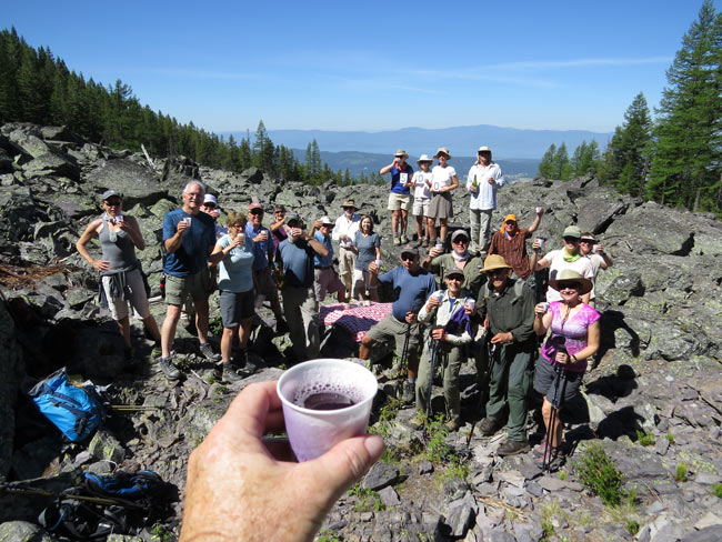
The Rangers toast 500 fun outings in the Swan Range! (Keith Hammer photos)
Twenty-three Swan Rangers celebrated the group's 500th Saturday outing at Elk Springs on June 27, 2015!
The first outing was to Elk Springs in November of 2005, but it didn't include champagne laced with homemade huckleberry wine!
The average group size has grown from 4 to 14 over the years and, with 474 different folks coming and going, averages nearly one new person each Saturday!
(Read Full Article)
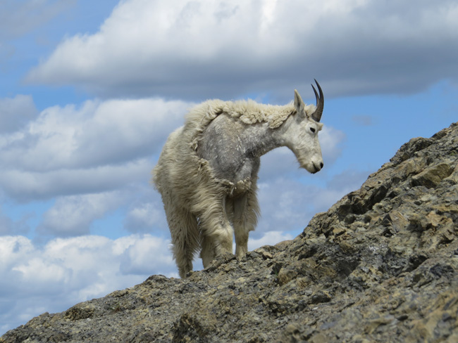
A mountain goat along the skyline of Mount Aeneas (Keith Hammer photos unless otherwise noted)
Nineteen Swan Rangers broke into several ragtag groups, hiking Mount Aeneas and other parts of Jewel Basin on Saturday, June 20, 2015!
A lone Ranger hiked past Twin Lakes, stopping short of descending snowy slopes to Wildcat Lake, and has kindly shared his photos here!
This was the 499th outing for the Swan Rangers, dating back to November of 2005. Stay tuned for champagne and treats on #500, June 27!
Click here for a map of the Jewel Basin Hiking Area.
(Read Full Article)
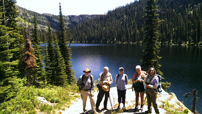
Rangers at Upper Holland Lake! (Susan Brueggeman photo)
Sixteen Swan Rangers broke into two groups and hiked to Upper Holland Lake and Strawberry Lake on Saturday, June 13, 2015!
The Swan Range is the eastern border of the Flathead and Swan Valleys - and all three have so many gorgeous lakes!
This was the 498th outing for the Swan Rangers, dating back to November of 2005. Stay tuned for champagne and treats on #500, June 27!
Click here for a map of the Strawberry Lake Trail and click here for a map showing Trails #415 and #35 to Upper Holland Lake starting on the north side of (Lower) Holland Lake (better hiking, less horse poop).
(Read Full Article)

Sun, sky and a smattering of Swan Rangers! (Keith Hammer photos except Mt. Aeneas view)
Nineteen Swan Rangers hiked the Switchback Trail up to Alpine Trail #7 on a sunny Saturday, June 6, 2015!
Two continued up from Malfunction Junction to the top of Mt. Aeneas!
Click here for a map of the Switchback Trail and click here for a map of Jewel Basin.
(Read Full Article)
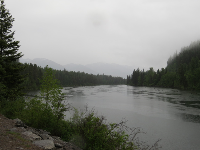
The Swan River and Swan Mountains in nifty shades of gray. (Keith Hammer photos)
Eight Swan Rangers spent a wonderfully rainy Saturday, May 30, hiking along the Swan River just upstream from Bigfork, MT!
It was the first truly rainy day in many weeks, though likely not enough to keep the paltry 0.11 inches of precipitation this May from breaking the record low of 0.23 in 2001!
Texas should feel free to send us some more of its excess!
(Read Full Article)
Page: ←1234567891011121314151617181920212223242526272829303132333435363738394041424344454647484950515253545556575859606162636465666768697071727374→